Subscribe to the 100% free rdnewsNOW daily newsletter!
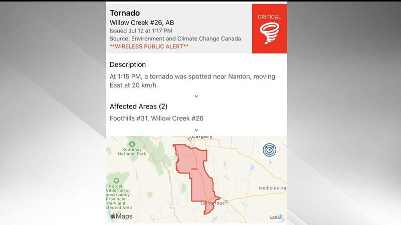
Alert sent out following reports of the tornado near Nanton on Sunday, July 12 (Environment and Climate Change Canada)
STORMY SUNDAY

Small tornado confirmed near Nanton on Sunday

Jul 13, 2020 | 7:11 AM

NANTON- Some residents near Nanton experienced some stormy conditions on Sunday afternoon.

Environment Canada has confirmed a tornado near the southern Alberta town.

The agency says the twister was seen from about 1:10 p.m. to 1:20 p.m. A dust cloud was spotted at the base of the funnel. Fortunately, there were no reports of damages.

Environment Canada has given the tornado a preliminary rating of EF0.

“This was considered a landspout tornado that was generated by weak rotation under rapidly growing clouds or weak thunderstorm,” reads the weather summary from Environment Canada.

“Landspout tornadoes do not usually cause significant damage but can still be dangerous as they can topple trees, damage roofs, or toss debris a short distance.”

Anyone who has any photos or videos of the tornado, or damage it may have caused, is asked to send them along to Environment Canada. That can be done by emailing abstorm@canada.ca or by tweeting the footage using the hashtag #ABstorm.

Additional Reports:

Environment Canada also noted several small funnel clouds across the province on Sunday.

The agency provided a summary of hail reports, in millimetres, in its latest weather summary.

· Spruce View: 30

· Innisfail: 26

· Caroline: 24

· Northwest of Eckville: 21

· Olds: 21

· West of Sundre: 21

In the Innisfail area, it was noted that hail had accumulated to several inches deep.

The following is a summary of peak wind gusts, in kilometres per hour:

· Brooks: 89 km/h

· Social Plains: 86 km/h

· Priddis: 84 km/h

· Highway 2, south of Nanton 511 camera: 83 km/h

(Lethbridge News Now)