(Government of Alberta/ screenshot)
likelihood and risks
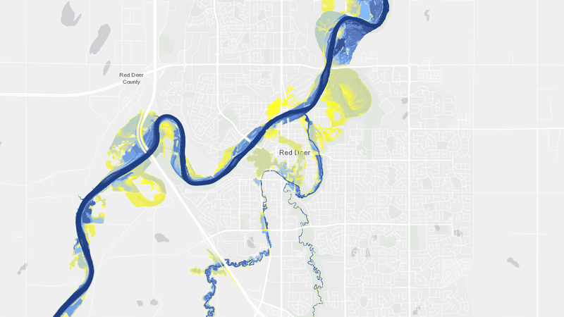
New flood maps by provincial government helps communities prepare for the future
May 27, 2025 | 3:55 PM
-
Share on Facebook
-
Share on Bluesky
-
Share on X
- Copy Link
The Government of Alberta has finalized new flood mapping for multiple communities throughout the province, including in Red Deer.
The map was created to not only raise awareness but also help communities prepare for flooding and respond more effectively.
In Red Deer, the map suggests that the likeliness of a flood along the Red Deer River over the next 30 years is high, however, it’s not a guarantee.
Carol Lind, emergency management coordinator with the City of Red Deer, said the risk of flooding each year is based on the conditions at the time rather than predictions.


