Get the free daily rdnewsNOW newsletter by subscribing here!
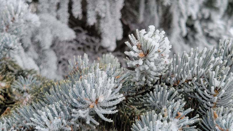
Rime ice caused by freezing fog seen this March in Red Deer. (rdnewsNOW/Josh Hall)
snow still on the horizon

Variable spring ahead for Red Deer after colder than average winter

Mar 24, 2022 | 9:18 AM

This past winter, defined by Environment and Climate Change Canada (ECCC) as December through February, was the 45th coldest in Red Deer over the last 102 years.

The city’s average temperature over those three months was -11.9° Celsius, compared to the 30-year average of -10.2°. That’s also the fourth coldest since 2012, or in the last 11 years.

A bit colder than average was the case for most of western Canada, says Terri Lang, ECCC meteorologist.

“We had a La Niña event this year, which was moderate to strong. That’s where the cold current sits off the coast of South America, and whatever surfaces off that coast, it mucks around with our jetstream position,” Lang explains. “Last year was a La Niña event as well, but it wasn’t as cold, and it was a bit drier. This year was stronger which is why we got the lower average temperatures.”

The two straight years of La Niña events — or a ‘double dip’ as the experts sometimes say — is also fairly uncommon, says Lang, explaining that it’ll often go back and forth between that and an El Niño.

Many places on the Prairies saw above average precipitation as well, though Red Deer was not included on that list. Between snow melted down, freezing rain and regular rain, figures from Lacombe Airport show just 13.1 mm, compared to a 30-year average of 40.6 mm at that site. That makes it the second driest winter in 100 years.

“The stations that measure snow under-catch it, especially when it’s windy. Number two, cities and towns tend to be snow traps; so when you drive around the Prairies, you think there’s less because there’s nothing to catch it, whereas in the city, you have big stacks because houses and trees catch it,” says Lang of the seemingly low number.

“When it’s colder, the moisture content of the snow tends to be lower, so you can have big fluffy dumps of snow and you can use a broom or blow at it,” says Lang. “Then when you melt it down, there isn’t as much moisture in it. The heavier snowfall comes when temperatures are closer to freezing (0°C).”

There was only one temperature record set in Red Deer this winter, on Feb. 6 when it was 10.2°C, beating the old record of 10.0°C on that day in 1963.

Speaking of snowfall, Lang says she wouldn’t be surprised if there were a few more good dumps before spring is said and done.

“Because La Niña is still hanging around, the forecast for all of western Canada is to be colder than average for the spring, which can be annoying for some folks, however, it’s beneficial in that it helps with the spring melt,” she says. “The melt will be slower, and that’s good for farmers and ranchers.”

Projections for southwestern Alberta are also for it to be drier than average.

“It’s spring on the Prairies and one thing to keep in mind is we get our heaviest precipitation events in the spring and fall, which are the shoulder seasons,” Lang concludes. “That’s because the atmosphere can tap into the warmer air, which can hold more moisture.”