Local news delivered daily to your email inbox. Subscribe for FREE to the rdnewsNOW newsletter.
(rdnewsNOW / Sheldon Spackman)
eyes on waterways

Officials closely monitoring localized flooding potential

Apr 21, 2020 | 3:16 PM

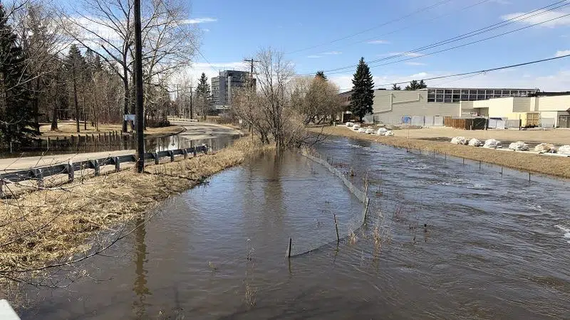
Rising water levels resulting from warmer temperatures are creating areas of localized flooding throughout Alberta. They’re also prompting City of Red Deer officials to encourage residents to keep their distance from rivers, creeks and streams.

Some areas in Red Deer have already been barricaded from members of the public due to flooded streets and nearby pathways. Those areas include a portion of 43 Street between 48 Avenue and 49 Avenue, the pathway parallel to 43 Street and Rotary Park, the entrance to Rotary Park, and 20 Avenue from 39 Street to 55 Street (including the multipurpose pathway).

City officials expect creek levels to return to normal in a few days. However, Emergency Management Coordinator Karen Mann says they are proactively monitoring high-risk locations at this time.

“In Red Deer, the Piper Creek and Waskasoo Creek tend to be of-risk for localized flooding earlier in the year than say the river,” she explains.

She points out that the Red Deer River has now opened up with both water and ice now flowing.

“What we watch for is localized run-off,” explains Mann,” how much water is coming into the river downstream of the Dickson Dam. Then we also monitor the information coming from the Dickson Dam and from the Alberta River Forecast Centre related to dam levels, as well as run-off from the mountains.”

Mann says it’s too early to predict, however, what the flow rates will peak at on the Red Deer River this year.

“They tend to flow at their highest through late May into June. So this time of year we’re really just monitoring that information and trying to get that picture so we can respond accordingly if we do have any sort of flood situation this year.”

Elsewhere in the Red Deer River Basin, an Ice Jam Watch was issued Sunday for an area west of Bowden near Red Lodge Provincial Park campground. Ice-related flooding was seen at Hwy 766 and Township Rd 340, southwest of the park.

Ice jam -related flooding on the Little Red Deer River west of Bowden. (Drone footage courtesy of Pat Boomer).

It’s also noted eastbound Highway 587 east of Range Road 25, near Red Lodge Provincial Park, eastbound lanes are closed due to water pooling on the highway. Drivers can expect one-lane alternating traffic through the westbound lanes and speed reduced to 50 km/h.

Jess Sinclair, Press Secretary for the Ministry of Environment and Parks, says given the higher than average snowpack and late spring thaw, a Spring Runoff Advisory was also issued for central and northern Alberta, including the Red Deer River basin.

“The ongoing melt may cause localized ponding in low-lying areas where water does not have a direct route to stream channels,” explains Sinclair. “Water levels may rise with a possibility of flooding in adjacent low-lying areas. In streams where ice is still present, the rising water levels may cause ice jams.”

Sinclair points out water levels have risen across the basin in response to snowmelt this past week.

“Although most of the snow cover has melted in areas east of Highway 2, there is still snowmelt left to occur to the west.” adds Sinclair. “As this snowmelt drains into the rivers, water levels can rise further or change rapidly as ice covers continue to break up.”

Mann says it’s simply best to stay away from ice and other bodies of water right now.

“If the ice looks like its thick enough to stand on, I can assure you at this time of year, it likely is not. Stay away from the ice on the edge of the river, it can break-up quickly and the river is flowing.

“Remind kids and youth of the same, so the creeks and the river, as we need to be cautious in those areas.”

For information on protecting your home and property from overland flooding, click here.