Local news delivered daily to your email inbox. Subscribe for FREE to the rdnewsNOW newsletter.
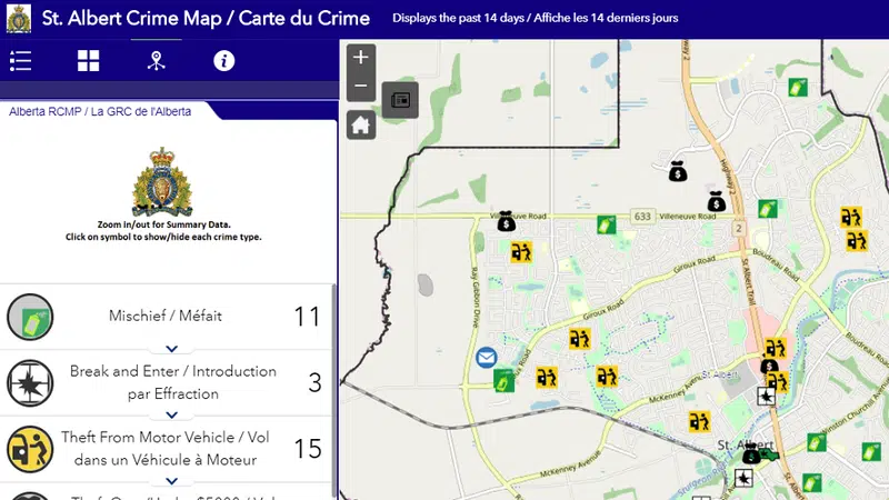
A crime map much like the one above from St. Albert will soon be launched in Red Deer for residents to see what types of crimes are happening in different areas of the city.
Crime Mapping

Approved in March, crime mapping coming very soon to Red Deer

May 16, 2019 | 10:23 AM

Red Deerians will soon be able to see what types of crimes are happening where in our community.

According to Director of Protective Services for The City of Red Deer, Paul Goranson, crime mapping for our city is expected to launch within four weeks.

Goranson says a considerable amount of preparation work has been done since council first approved it in March.

“It involved training a number of staff that will actually be keying-in the data on a daily basis, so that has been completed,” says Goranson. “We did have to decide on which actual crimes were going to be mapped, so we’ve just completed that decision as well.”

Prior to that, Goranson says The City will be putting out public communication to notify residents of where to find and how to use crime mapping information.

“You’ll be able to see within the boundaries of Red Deer any crimes related to mischief, break and enters, theft of motor vehicles, theft from motor vehicles and theft under $5,000,” he explains. “We want to put information up there that may help create awareness in neighbourhoods about things that you may not be aware of that are happening so you can take reasonable precautions.”

Council’s approval also left the door open for theft over $5,000 and missing persons to be posted, but Goranson notes they won’t be including those.

“As far as missing persons goes, the RCMP and our communications do put out alerts on a regular basis,” he says. “When people are missing, the geographical location doesn’t necessarily help in recovery and finding of the individuals because if they’re missing in an area, then they’re somewhere else.”

Through an internal version of the application and combined with other technologies, Alberta RCMP say they can develop geographical crime hotspots to guide targeted enforcement initiatives.

“When you look at other municipalities in western Canada and most of Canada, most are doing this now,” adds Goranson.

“The thinking behind it is it does educate, it does help people understand what is or isn’t happening in their respective areas, so it’s an education tool. In talking with Crime Prevention and the neighbourhood associations, they’re quite interested in having this available so that it can create opportunities for discussions and lead to targeted campaigns.”

Launched in October of 2018 by RCMP K-Division, the initiative will run as a one-year pilot project in Red Deer at no cost to taxpayers, with a report and analysis to come back to council down the road.

Once ready to go, crime data from the past 14 days will be provided, while data older than 14 days will disappear. The map will provide street names, but not the addresses of homes.

Publicly available crime mapping is already up and running in communities like Innisfail, Blackfalds, Sylvan Lake, Camrose County, Beaumont, Edmonton, St. Albert, Calgary and Wood Buffalo.