Local news delivered daily to your email inbox. Subscribe for FREE to the rdnewsNOW newsletter.
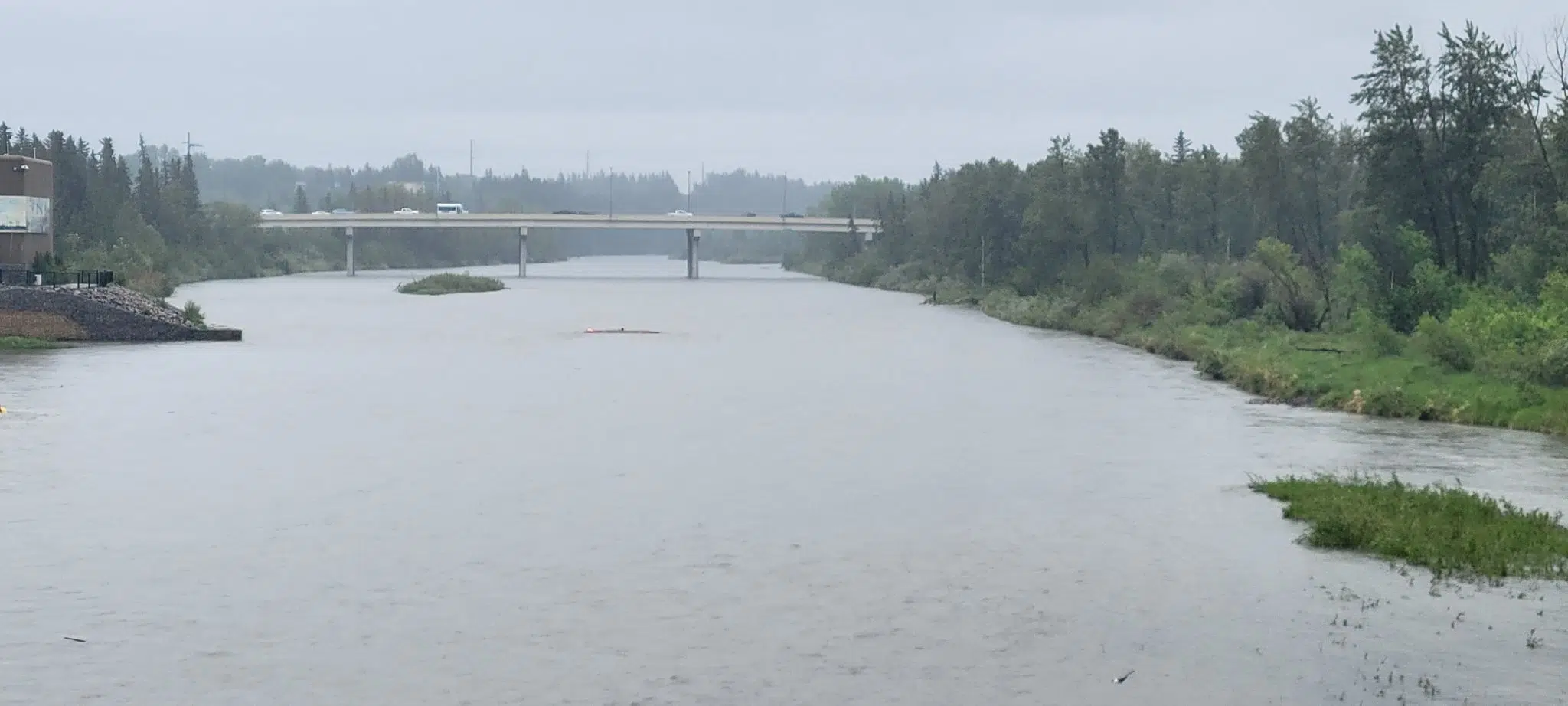
The Red Deer River from the CP walking bridge in Red Deer at 3 p.m. on Tuesday, June 14. (rdnewsNOW/Josh Hall)
UPDATED - JUNE 17, 11 a.m.

City of Red Deer deactivates emergency operations centre as river stabilizes

Jun 14, 2022 | 10:15 AM

UPDATE – 11 a.m., June 17

Statement from The City of Red Deer:

“Today at noon, The City’s Emergency Operations Centre will demobilize as flood concerns for our community have subsided.

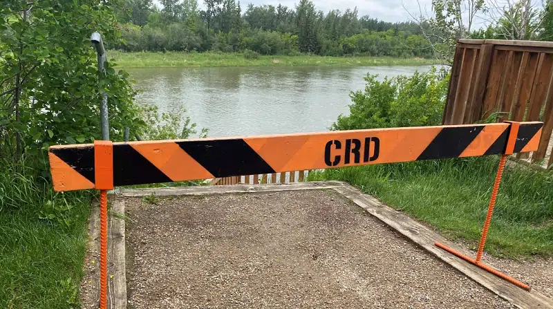
Since yesterday afternoon, water levels on the Red Deer River and tributaries have stabilized, as well as outflow rates from Dickson Dam. However, the Red Deer River remains under a high streamflow advisory by Alberta Environment and boat launches into the river remain closed.

“We continue to urge people to stay off of the river and the shore while the high streamflow advisory remains in effect,” said Ken McMullen, Director of Emergency Management. “The river has risen significantly this week, and we are seeing natural debris in the river such as fallen trees which pose a significant safety concern to anyone recreating on the river.”

The Lions Campground, which was closed on Tuesday, will re-open to campers today at noon.”

[OLDER] – 3 p.m., June 16

The City of Red Deer says the rising water has peaked on the Red Deer River, after a jump of about 1.5 metres.

It will remain at its peak level for eight to 12 hours, and the river remains under a high streamflow advisory.

People are urged to stay off of it, with Emergency Management Director Ken McMullen pointing out that being on the river would be more dangerous now than it was earlier in the week because of all the debris that’s now flowing down it.

“This afternoon we received information from the Dickson Dam and Alberta Environment that water levels have begun to peak on the Red Deer River, which is positive news and one factor we use when assessing flood risk,” said McMullen. “Other factors we consider in addition to the level of the Red Deer River, is water levels on the Little Red Deer and Medicine rivers that feed into the Red Deer River downstream of the dam, how quickly snowmelt is occurring in the mountains, as well the precipitation our city and region are experiencing.”

There was mild low-level flooding at McKenzie Trails over the last 24 hours, though it caused no damage. All boat launches, as well as Lions Campground remain closed.

However, outdoor sports fields, the downtown spray park, Capstone fountain, the outdoor pool, and Great Chief Park are now reopened.

More rain is forecast for the weekend, and the City continues to monitor the situation.

According to the City, about 80 mm of rain was recorded from noon on Monday, June 13 to noon on Wednesday, June 15, a period of 48 hours. About 61 mm was recorded at the wastewater treatment plant.

At Lacombe Airport, the nearest spot where Environment Canada obtains readings, 76.2 mm fell over the 72 hours from noon on Sunday, June 12 to noon on Wednesday, June 15, with more than 40 mm falling on June 14th alone, an all-time record.

In that same 72-hour span, 84.5 mm fell in Rocky Mountain House, and topping the list was Kananaskis region, which got a dump of 218 mm. Olds had 86.5 mm and Breton had 94.5 mm, according to Environment Canada.

Red Deer is currently about 20 mm shy of its June average for precipitation of 94 mm.

Sara Hoffman, Environment and Climate Change Canada meteorologist, says…

“We’re going to continue in this unstable pattern through the rest of the week, and it’s hard to say how much rain will fall. It will be dominated by local pockets of heavier precipitation,” says Hoffman. “So when we get those periods of sunshine, if you had issues with your eavestrough, that is the time to get out and fix that up.”

Hoffman added that while other parts of the country may look at a 94 mm average for the month and laugh, on the Prairies, it is referred to as the ‘June Monsoon,’ with this month and next the rainiest of the year.

“We do often see these big systems drop a bunch of rain. What may be unusual about this one is that we haven’t seen it much in recent history. It’s been drier for the last couple years, and it’s easy to forget that June can be very showery,” Hoffman adds.

“What might also be unusual is the direction it took. We’re not used to seeing it all the time where the low pressure system goes east to west, and we call that retrogressing. Eventually it did move east, but for days, it was retrogressing which caused most of our issues. The terrain enhanced the rainfall amount with he moist air forced upward by the foothills and mountains.”

According to rivers.alberta.ca, which is where you can check for the most up-to-date water level and flood risk updates, the following advisories are in place:

*These river status descriptions may be outdated. Please check rivers.alberta.ca for the latest.

Flood warning (Water level PEAKING as of 3 p.m. June 16)

-Little Red Deer River

High Streamflow (Water level FALLING as of 3 p.m. June 16)

-Tributaries of the Red Deer River between Burnt Timber Creek and Gleniffer Reservoir including Bearberry, Fallentimber, James and Raven Rivers

-Red Deer River basin upstream of Burnt Timber Creek and along the mainstem to Gleniffer Reservoir

High streamflow (Water level FLUCTUATING as of 3 p.m. June 16)

-Red Deer River mainstem from the Dickson Dam to the Saskatchewan border

High streamflow (Water level PEAKING as of 3 p.m. June 16)

Medicine River

River Impacts

  • Red Deer River upstream of Glennifer Reservoir – Current forecasts result in lower water level changes.  No known impacts are expected at this time. Water level rises of 1-1.5 metres are possible;
  • Red Deer mainstem – peak is expected at the City of Red Deer, Thursday June 16th (~1.3 m rise – no impacts), and at the Town of Drumheller on Saturday, June 18th (~1.5 m rise – no impacts)
  • Little Red Deer River – Hwy 587 and campgrounds closed due to flooding. The Little Red River at the Mouth gauge is peaking.

[OLDER] – 2:30 p.m., June 15

The flood situation for Red Deer is dynamic, says The City of Red Deer’s Emergency Management Director, Ken McMullen.

This after at least 61 millimetres of rain was measured at the City’s wastewater treatment plant over the last 48 hours. The rainfall warning ended just before noon Wednesday.

“The situation is changing within minutes, as flow rates are continuously fluctuating. This morning, outflows from the Dickson Dam increased to about 250 cubic meters per second, whereas earlier it was flowing at 123 cubic metres per second,” said McMullen, noting that a high streamflow advisory remains in place for the Red Deer River.

“What that means for us is that we expect to see the Red Deer River rising approximately one metre starting between 6 and 7 p.m. tonight, and peaking sometime tomorrow (Thursday) afternoon.”

McMullen continued: “Our mapping indicates we expect the impact of this to be contained strictly to the parks system, with flooding expected in McKenzie Trails and the trails within that area. It’s important to note that no residential impacts are expected at this time.”

Barricades are in place at many spots along the river, with McMullen restating that everyone is to stay off the river, and that all boat launches remain closed.

To this point, Red Deer Emergency Services has not had to respond to any distress calls on related to people on the river.

There are three factors at play in the dynamic situation, McMullen explained.

“Rainfall is only one consideration. The others are the outflow rates from the Dickson Dam and the rate at which the snowpack melts from the mountains in the Rockies that directly feed into the Red Deer River,” he said Wednesday afternoon.

Closures

City of Red Deer

  • Lions Campground
  • Capstone ‘Canada 150’ fountain
  • Outdoor pool at the Recreation Centre
  • Blue Grass spray park downtown
  • All sports fields
  • Boat launches

Red Deer County

  • A-Soo-Wuh-Um Park
  • and the Joffre Bridge Day Use Area

Provincially

  • Bow River campground
  • Three Sisters campground
  • Crescent Falls provincial recreation area
  • Seven Mile provincial recreation area
  • Prairie Creek provincial recreation area
  • Tay River provincial recreation area
  • Medicine Lake provincial recreation area
  • Red Lodge Provincial Park
  • Strachan provincial recreation area
  • McKinnon Flats day-use area
  • access roads to Dry Island Buffalo Jump Provincial Park

This story will be updated as the situation evolves, and as The City updates media.

(City of Red Deer)

[OLDER] – 12 p.m., June 15

A rainfall warning for Red Deer ended just before noon on Wednesday, however, The City continues to monitor local waterways from its Emergency Operations Centre, which was activated Tuesday morning.

A high streamflow advisory remains in effect on the Red Deer River.

“Outflows predicted for the Red Deer River remain dynamic and we anticipate water levels to rise on the Red Deer River by this evening, however significant flooding is not expected at this time,” said Ken McMullen, Director of Emergency Management. “All access to the river is barricaded and we urge everyone to stay off the river and away from the banks at this time.”

On Tuesday, The City noted that river levels were rising rapidly and urged people to stay off the river for safety reasons.

Ken McMullen, The City of Red Deer’s Emergency Management Director, gives an update Tuesday afternoon from the Emergency Operations Centre. (rdnewsNOW/Josh Hall)


It was also shared that out of an abundance of caution, the entirety of Lions Campground (50 trailers) had been evacuated, with campers relocated to Westerner Park. The biggest current threat, it was said, is to the parks and trails system, particularly at McKenzie Trails.

There remains no imminent risk to the public or property.

The City said Tuesday morning it was working to protect infrastructure and prepare for potential flooding, with crews preparing sandbags and working to ensure they are ready to respond, at a moment’s notice, over the course of 48 hours.

Activating the Emergency Operations Centre allows emergency crews to monitor conditions in a coordinated way, prepare mitigation efforts and prepare a coordinated response for anticipated flooding.

Other tips from the City

  • Stay off the Red Deer River.
  • Ensure your downspouts are working and are down
  • If you use rain barrels, consider draining them regularly away from your house
  • Report blocked catch basins to Public Works at 403.342.8238
  • Remove important documents and items from your basement
  • If you have a sump pump, ensure it is working
  • Drive according to conditions and avoid driving through pooled water
  • Obey all closures and barricades

All boat launches into the river remain closed. Residents are asked to stay off the river as conditions will change quickly.

“Alberta’s government and the Alberta Emergency Management Agency are closely monitoring flood risks in central and southern Alberta. Although our cities and towns have much better on-the-ground flood protection in place than in previous years, we will be watching weather developments and river levels closely over the coming days. The Alberta government is at the ready to take action and coordinate with local communities should flooding conditions develop,” says a statement from Minister of Municipal Affairs Ric McIver and Minister of Environment and Parks Jason Nixon, issued Monday night.

“To all residents in the affected communities, please ensure you and your family are prepared and follow the directions of local officials. If you haven’t done so already, please download the Alberta River app and the Alberta Emergency Alert app to keep informed.”

More information about flood preparedness is also at reddeer.ca/flood.