Local news delivered daily to your email inbox. Subscribe for FREE to the rdnewsNOW newsletter.

Alberta gets federal disaster mitigation funding

Dec 17, 2018 | 11:48 AM

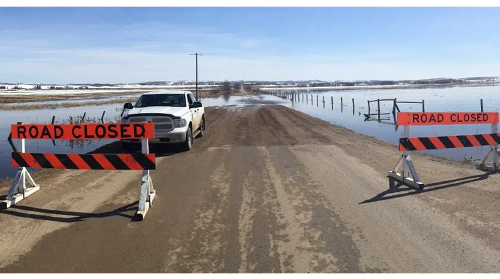
More than two dozen Alberta communities including Red Deer are getting funding for new and replacement flood mapping to support emergency response and long-term planning.

The federal government has announced $8.7 million through the National Disaster Mitigation Program for 18 projects.

They include new or replacement flood mapping for Red Deer, Drumheller, Medicine Hat, Siksika Nation, and more than 100 kilometres of the North Saskatchewan River, including Edmonton.

Officials say the province is contributing more than $5 million to the projects as part of the cost-sharing agreement.

“Our government is committed to investing in flood resilience to better protect Albertans where they live and work,” says Shannon Phillips, Minister of Environment and Parks, in a press release. “The provincial and federal funding for flood mapping and community risk assessments will help us build safer communities over the long term and ensure Alberta is better prepared for severe weather events in the future.”

“The Government of Canada, in partnership with provinces and territories, is committed to reducing the impacts of flooding on Canadians by investing in projects that allow communities to identify, plan for, and reduce flood risks,” adds Randy Boissonnault, Member of Parliament for Edmonton Centre, on behalf of the Minister of Public Safety and Emergency Preparedness. 

“Investing in programming like the National Disaster Mitigation Program is an important part of the Government of Canada’s strategy to address the soaring costs of natural disasters. The projects announced today will help the province of Alberta better prepare for and respond to floods.”

Provincial and federal funding will also be used to assess the potential for debris floods near Canmore, stormwater vulnerabilities in Calgary and flood risks in smaller communities such as Lacombe, Stettler, Manning and the Municipal District of Crowsnest Pass.

According to officials, projects to improve forecasting and warning systems and improve access and interaction with provincial flood-inundation maps also received funding, with Alberta launching 13 river hazard studies since 2015, including those that are wholly funded by the province.

In total, these studies are anticipated to produce new and replacement flood mapping for over 1,300 kilometres of river through more than 30 communities with many of these studies said to be nearing completion.

Officials point-out a hazard study for the Red Deer River was initiated on August 1, 2017 and has received $765,000 in funding from both the provincial and federal governments for a total of $1,530,000.

The two-year project is described as assessing and identifying river and flood hazards within the city of Red Deer, the town of Penhold, Red Deer County, and Lacombe County.

The map will also be used to ensure future developments are not built in areas where flooding has been identified as a concern.

In the event of a flood, the map will benefit emergency responders by helping them decide the best route of evacuation, as well as informing the best location for the construction of temporary flood control barriers.

Elsewhere, a two-year hazard study for the upper Red Deer River began August 1, 2017 and has received $697,500 in both provincial and federal funding for a total of $1,395,000.

This project is described as producing a flood hazard map along the Red Deer River and Bearberry Creek.

The map will be used to ensure future developments are not built in areas where flooding has been identified as a concern.

In the event of a flood, the map will benefit emergency responders by helping them decide the best route of evacuation, as well as informing the best location for the construction of temporary flood control barriers.

Also, a two-year community risk assessment for central Alberta which began on September 5, 2017 includes $120,060 in funding from both the provincial and federal governments for a total project value of $240,120.

Using the Provincial Flood Damage Assessment Tool (PFDAT), officials say it will be used by community members and the province to better understand flood vulnerability for a range of flood events in the communities of Lacombe, Stettler, Millet and Carbon.

With the improved capacity, these four communities are expected to be able to better plan and implement mitigation strategies that will reduce the impact of flooding.

Since 2013, officials say the Alberta government has invested more than $700 million in community-level resilience projects, erosion control, upstream storage, flood mapping, flood forecasting and emergency preparedness, and watershed health to improve flood and drought resilience across the province.

(With files from the Alberta Government)